

01
Stansbury & Oyster Bay
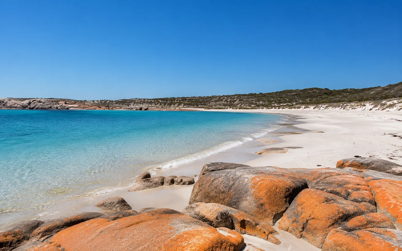
Calm eastern coastBeach, jetty, all-tide boat ramp, picnic foreshore and a 6.3 km local coastal trail make Stansbury an easy all-round outdoor stop.
Best for: an uncomplicated half-day by the water.
Yorke Peninsula · South Australia
Choose the coast by the day you want
Calm eastern bays, fishing jetties, long coastal trails, snorkelling water, surf beaches and the wild headlands of Dhilba Guuranda–Innes National Park give the peninsula several very different outdoor experiences.
A common mistake is to treat the peninsula as one long beach. It is not. The eastern side around Stansbury, Port Vincent, Wool Bay and Edithburgh often gives visitors a gentler first experience: town beaches, jetties, foreshore paths, boat ramps, shallow water and places where a coastal stop can fit comfortably into a wider day of sightseeing.
The western side becomes more open to Spencer Gulf. Around Port Victoria, Port Rickaby, Point Turton, Port Hughes and Moonta Bay, fishing, boating, sunsets and long views across the gulf become more prominent. Some beaches remain protected, while headlands and reef edges feel more exposed.
At the southern end, Marion Bay is the threshold to Dhilba Guuranda–Innes National Park. Here the coast becomes the main event: cliffs, surf, beaches backed by low heath, lighthouses, shipwreck history and walking trails that can occupy an entire day without any need to add a town attraction.
That variety is the strength of Yorke Peninsula outdoors. A family looking for calm water, a walker wanting a two-hour coastal section, a diver looking for jetty marine life and a surfer chasing exposed ocean conditions should not all be sent to the same place. Choose by activity and exposure first, then by distance.
Beach, jetty, all-tide boat ramp, picnic foreshore and a 6.3 km local coastal trail make Stansbury an easy all-round outdoor stop.

A protected town beach, marina, swimming, snorkelling and cliff-top walks suit families and travellers who prefer calmer water to exposed surf.

The jetty is a major diving and snorkelling location, while the tidal swimming pool and beaches add easier water options close to town.

Sandy beaches and sheltered water make this a quieter family option, with a natural swimming pool south of town and access to Walk the Yorke.

A small coastal base with both swimming and surf beaches, plus straightforward access to the national park immediately to the west.

Cliffs, surf breaks, secluded beaches, walking trails, wildlife, lighthouses and maritime history make this the peninsula’s standout full-day outdoor destination.

Long jetties, swimming areas, fishing and foreshore walking combine with easy access to Moonta and Wallaroo.

Fishing and diving sit beside maritime history, Wardang Island views and coastal walking, with quieter beach settlements continuing south toward Point Turton.

Stansbury works well as an outdoor base because the coast is woven into the town. The jetty, beach, foreshore reserve, playground, picnic facilities, boat ramp and walking trail all sit close enough together that visitors can decide what to do after they arrive rather than committing to a complicated itinerary.
The bay is sheltered compared with the exposed south-west coast. Yorke Peninsula tourism information describes the sandy beach and calm water as suitable for swimming and other beach activities, while the jetty and beach are both used for fishing. Seasonal catches commonly associated with Stansbury include King George whiting, garfish, mullet, tommies and squid; blue swimmer crabs are also taken from the shallows, jetty or boat in season.
The local coastal walk extends 6.3 km from the jetty area to Pitts Cutting. Its three stages let you shorten the outing: paved foreshore sections suit a casual walk, while the southern extension adds higher cliff-top views and more coastal vegetation. For most visitors, that flexibility works better than treating the entire Walk the Yorke route as an all-or-nothing hike.
Walk the Yorke is a coastal walking and cycling network of more than 500 km, divided into 16 principal point-to-point sections. It passes beaches, towns, coves, jetties and lighthouse country, so visitors do not need to tackle a multi-day expedition to use it. Short pieces around towns often make the simplest introduction.
Stansbury sits between two official sections. Port Vincent to Stansbury is 17.6 km and is listed at about 4 hours 24 minutes, but it can be broken into Port Vincent–Lime Kiln Gully, Lime Kiln Gully–Beach Hut and Beach Hut–Stansbury. Southbound, Stansbury to Edithburgh is 29.2 km and can be divided at Wool Bay and Hickeys Point.
Longer sections require more planning than a normal town walk. Official trail notes advise walkers to plan the return journey, carry water, allow for weather and ability, watch for high-tide trail markers and remember that mobile coverage is not reliable everywhere. A PLB is recommended for longer outings.
Short sections are often the better visitor experience
One of the shorter full Walk the Yorke sections, combining shared trail, beach walking and cliff-top country.
A manageable final portion if the full Port Vincent section is too long for the day.
The first southern segment toward Edithburgh and a longer day walk with transport arranged.
A serious full section, officially estimated at more than seven hours and better planned in advance.
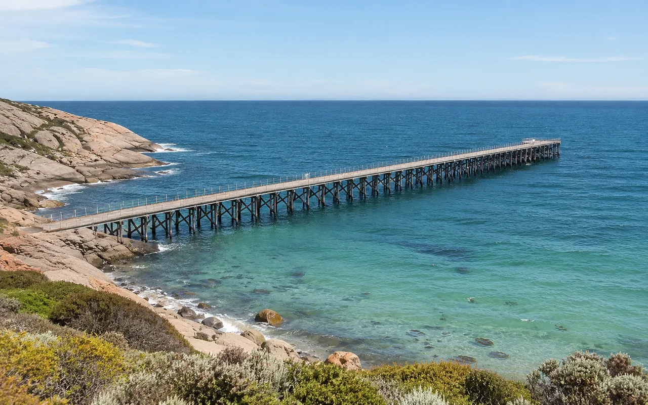
Historic jetties remain working recreation spaces. Stansbury, Ardrossan, Edithburgh, Wallaroo, Port Hughes, Moonta Bay, Port Victoria and Port Broughton are among the better-known land-based options.
Open beaches add salmon and surf-fishing possibilities, particularly toward the south-west. Browns Beach in the national park is one recognised shore-fishing location.
Shallow eastern-coast water is especially associated with crabbing. Stansbury, Ardrossan and nearby eastern settlements are common places for the activity.
Edithburgh Jetty is the standout easy-to-name location because marine life gathers around the pylons. Port Victoria and Wool Bay are also promoted for jetty snorkelling.
Edithburgh works across experience levels, while the peninsula also has deeper and more advanced wreck and reef diving. Conditions, qualifications and local advice matter more than a simple destination list.
Pondalowie Bay and Chinaman’s Beach sit on the exposed national-park coast. They should be treated very differently from Stansbury or Port Vincent’s sheltered water.
Species limits, seasonal rules, marine-park zones and temporary fishing closures are not fixed website copy. Check current South Australian recreational fishing rules and local conditions before setting out.
| Area | Character | Good fit | Think about |
|---|---|---|---|
| Stansbury / Oyster Bay | Sheltered eastern bay beside town facilities | Swimming, fishing, beach time, short walks, boating | Easy to combine activities without moving the car much |
| Port Vincent | Protected bay and town beach | Families, swimming, boating, snorkelling, relaxed foreshore time | A strong alternative when open-ocean conditions are not the goal |
| Edithburgh | Town beaches plus major jetty habitat | Snorkelling, diving, fishing, tidal-pool swimming | Marine-life visibility depends on sea conditions |
| Hardwicke Bay | Quiet, sheltered Spencer Gulf water | Family swimming, boating, fishing | Better for a slow beach day than a packed attraction list |
| Marion Bay | Choice of sheltered and surf-facing beaches | Base for mixed beach days and national-park access | Holiday periods are much busier than normal |
| Dolphin / Shell / Pondalowie | National-park beaches with a wilder setting | Scenery, photography, swimming in suitable conditions, surf at selected breaks | More exposure, fewer town services, park rules apply |
| Port Hughes / Moonta Bay | Long jetties and accessible town beaches | Fishing, family water time, sunset walks | Useful when combining coast with Copper Coast heritage towns |
| Port Victoria / Point Turton | Western maritime coast, reefs, jetties and bays | Fishing, diving, snorkelling, boating, sunsets | Choose the exact site around wind and sea state |
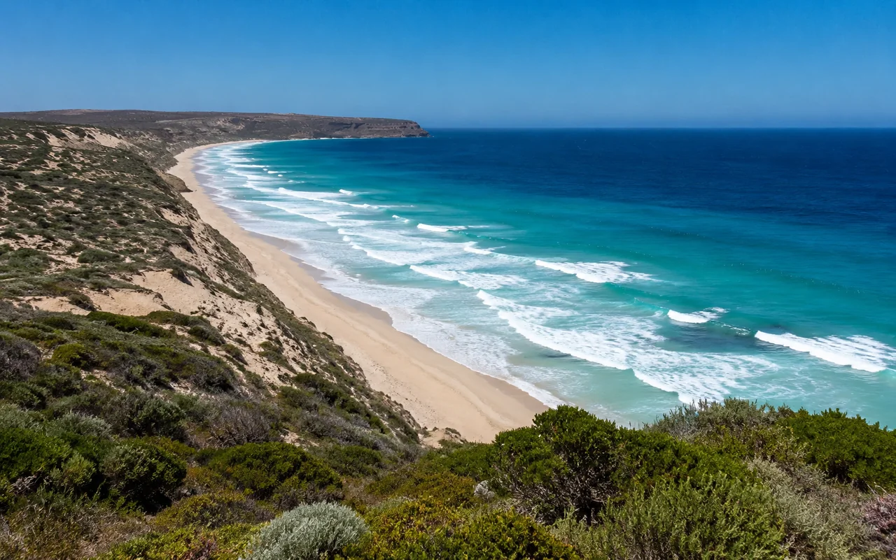
The national park is the point where Yorke Peninsula stops feeling like a sequence of holiday towns and becomes a large coastal landscape. Official park information highlights camping, fishing, surfing, birdwatching, snorkelling and bushwalking, with walks ranging from short half-hour outings to hikes of several hours.
The Stenhouse Bay Lookout Walk is an accessible introduction to the park’s scale: a 2 km loop taking roughly an hour, with cliff-top views over Investigator Strait and multiple lookouts. The West Cape Headland Hike adds broad coastal views, while the Inneston Historic Walk combines outdoor movement with the abandoned gypsum-mining township.
Wildlife is part of the experience rather than a guaranteed sighting list. Tammar wallabies were reintroduced to the park, ospreys breed along the coast and threatened hooded plovers nest on beaches. Visitors should give beach-nesting birds space and remember that pets are not permitted in the national park.
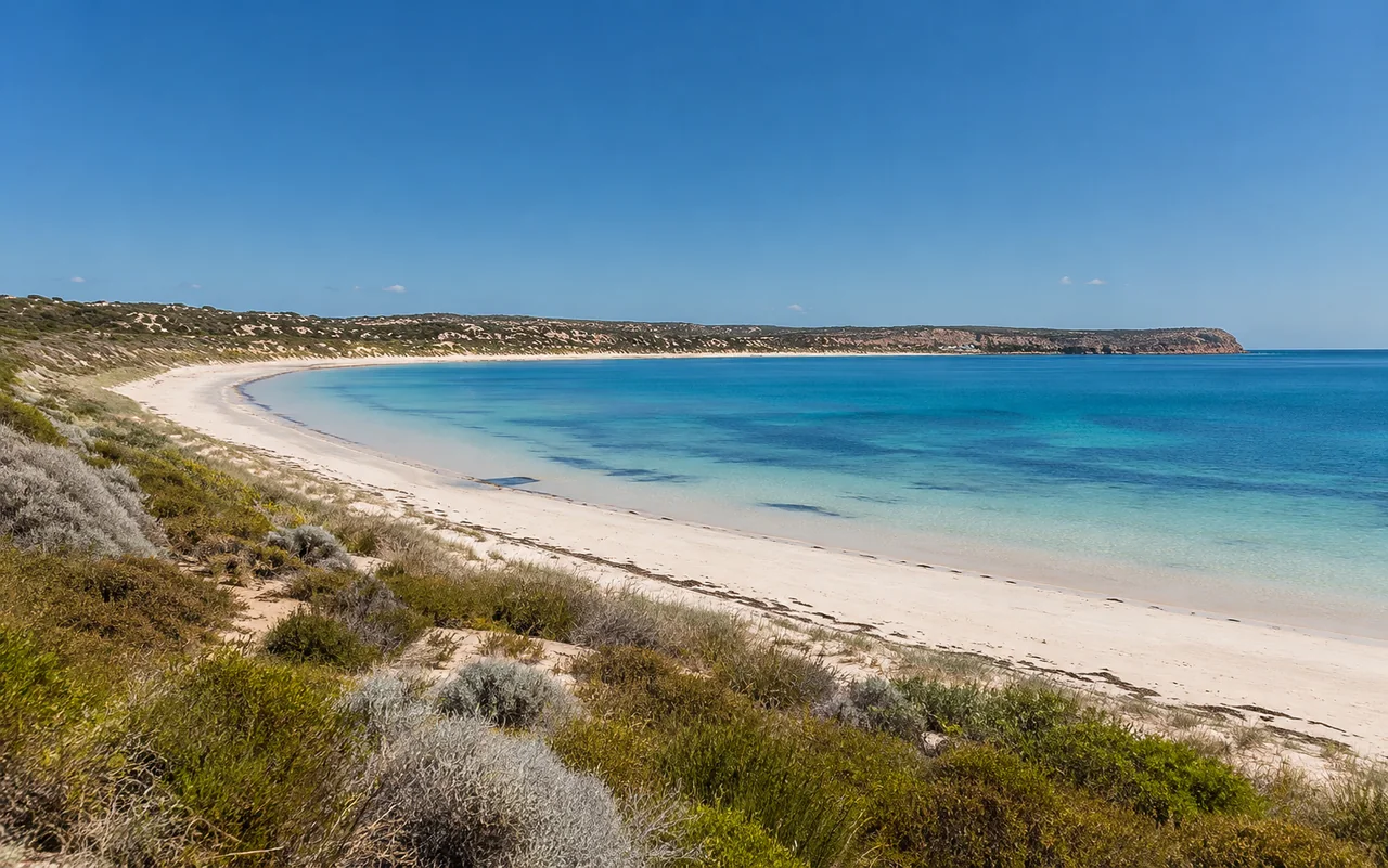

Stansbury’s shallows are associated with pelicans, black swans and other waterbirds, especially along the local coastal trail and sand-flat areas.
Pylons create structure for fish and invertebrates. Edithburgh is particularly well known for seahorses, leafy sea dragons, cuttlefish and other marine life.
Ospreys and sea eagles use the southern coast, while high viewpoints also give the best chance of spotting dolphins or seasonal whale movement offshore.
Tammar wallabies, emus and diverse birdlife add a land-based wildlife layer to a park most visitors first notice for beaches and cliffs.
Jetty, short foreshore walk, beach and picnic stop. Add a little of the coastal trail if the weather suits.
Compare two sheltered eastern-coast towns, with walking, swimming or fishing depending on conditions.
Start calm at Oyster Bay, then continue south for jetty marine life, tidal-pool swimming and a different coastal character.
Give the park the day: one or two short walks, a lighthouse or historic stop, beaches and enough time to change plans with the weather.
Before heading out
Sheltered town beaches are generally the gentlest family option. Port Vincent is known for a protected bay and town beach, Stansbury has calm Oyster Bay conditions, and Hardwicke Bay is also known for sheltered water. Always judge conditions on the day.
Stansbury has a 6.3 km coastal trail from the jetty area to Pitts Cutting, with shorter paved and foreshore stages. It also sits between the Port Vincent–Stansbury and Stansbury–Edithburgh sections of Walk the Yorke.
Walk the Yorke is a continuous coastal walking and cycling network of more than 500 km, divided into 16 main point-to-point sections around the peninsula.
Edithburgh Jetty is one of the region’s best-known snorkelling and diving locations. Yorke Peninsula tourism information also highlights Port Victoria and Wool Bay jetties for marine life, while Point Riley near Wallaroo offers shore-based snorkelling.
The exposed south-west coast is the main surf zone. Dhilba Guuranda–Innes National Park includes well-known breaks around Pondalowie Bay and Chinaman’s Beach, where conditions can be powerful and are best matched to experience.
Yes. Jetty fishing is one of the peninsula’s defining outdoor activities, with popular options including Stansbury, Ardrossan, Edithburgh, Wallaroo, Port Hughes, Moonta Bay, Port Victoria and Port Broughton. Current recreational fishing rules and closures should be checked before fishing.
Dhilba Guuranda–Innes National Park is a strong wildlife area, with tammar wallabies, emus, ospreys and other coastal birdlife. Around Stansbury, pelicans, black swans and other waterbirds are commonly associated with the shallows and coastal trail.
Pets are not permitted in Dhilba Guuranda–Innes National Park, although accredited assistance dogs are allowed under South Australian parks rules.
Yes. Stansbury combines its own beach, jetty, boat ramp and coastal trail with a central position on the eastern side of Yorke Peninsula. Port Vincent and Edithburgh are easy coastal additions, while the national park is a longer full-day trip south.
Check the forecast, wind, tides, local beach conditions and any current park or trail notices. For longer Walk the Yorke sections, carry water, plan the return journey and do not rely on continuous mobile coverage.