
Eastern coast
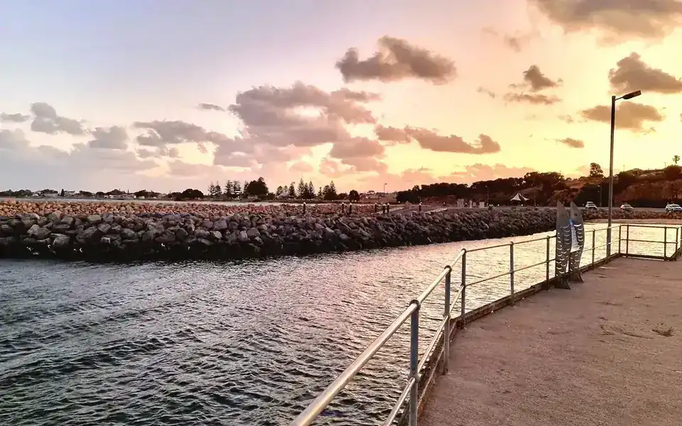
Sheltered gulfs, jetties, boating access, town beaches and relatively protected coastal sections.
Yorke Peninsula · South Australia
Museums, local attractions and coast
A visitor overview of Stansbury on Oyster Bay, covering the foreshore, museum, local history, coastal walks and day trips across Yorke Peninsula.
Stansbury stands on the eastern side of Yorke Peninsula, facing Gulf St Vincent from the sheltered curve of Oyster Bay. This position explains the town’s calm central foreshore, its long history of maritime access and its continuing use for swimming, fishing, crabbing, boating and short coastal walks.
The bay shaped the town’s early economy as well as its appearance. Wild oyster beds gave the settlement its earlier name, Oyster Bay, while the jetty linked nearby grain and pastoral districts with coastal shipping. The present jetty opened in 1905 after the earlier structure proved too shallow for larger steamships.
The centre is easy to explore on foot. The jetty reserve, Harbour Masters Park, beach, playgrounds, picnic facilities, visitor information centre and main streets all sit close together. A first-time visitor can get their bearings along the waterfront before continuing to the museum, coastal trail, lookout or neighbouring towns.
Behind the foreshore are farms, former transport and service buildings, limestone quarrying and community institutions. Stansbury Museum brings these parts of local life together through displays on households, schooling, farming, oyster work, machinery, photography, sport and community organisations.
Stansbury is a small working coastal town rather than a large resort. Its appeal comes from the close link between the bay, local industries and the ways families adapted to dryland farming, limited transport and changing technology.
For a first visit, start at the foreshore and jetty. From there, add one main activity: Stansbury Museum, part of the 6.3-kilometre coastal trail, fishing or crabbing, the town’s murals, or a longer drive across Yorke Peninsula.
Around the peninsula
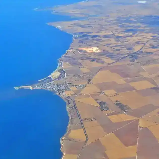
Yorke Peninsula is the traditional Country of the Narungga (Nharangga) people and is bordered by sea on three sides. Around Stansbury, the east coast faces Gulf St Vincent and is generally more sheltered than the southern and south-western coasts. That contrast helps explain the differences in beaches, wave exposure, boating conditions and walking routes around the peninsula.
Stansbury sits in a central position on the lower east coast. Port Vincent lies to the north, Edithburgh and Coobowie to the south, and Yorketown inland. The Copper Coast and Dhilba Guuranda–Innes National Park are each about 110 kilometres away, putting both within day-trip range from town.
Sheltered gulfs, jetties, boating access, town beaches and relatively protected coastal sections.
More exposed headlands, cliffs, reef platforms, pocket beaches and stronger ocean influence.
Dryland agriculture, salt-lake country, small service towns and routes linking both coasts.
Across the peninsula, museums cover farming innovation, copper mining, maritime trade, domestic life and military history.

Museum and local history
Opening is limited and volunteer-run. Confirm current hours before making a special trip.
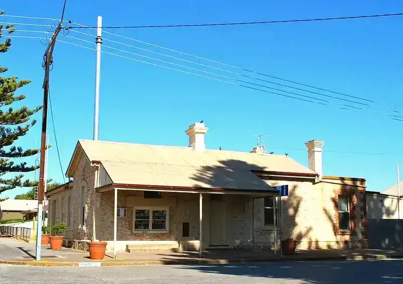
The museum occupies the original government school and adjoining headmaster’s residence, built in 1878. Rooms once used for teaching and family life now hold displays about the town and surrounding district.
The collection covers many parts of local life. Recreated rooms show sleeping, cooking, dining and sitting spaces, while clothing displays include sewing, knitting and lacemaking. Other areas cover bottles, clocks, cameras, office equipment, shells, minerals, local sport, community organisations and military remembrance.
Larger exhibits connect the museum with work beyond the town centre. Farming implements, engines, one of the town’s original fire trucks, an oyster dredge, a scale model of Riddle Windmill and locally made machinery show how people farmed, travelled and worked.
The reading and research room holds cemetery records, family trees and local reference material, supporting family-history and district research.
| Building | Original schoolroom and headmaster’s residence, built in 1878. | The rooms help explain early education, family life and community growth. |
|---|---|---|
| Core collections | Domestic interiors, clothing, photography, bottles, minerals, office equipment, sport and civic material. | A broad view of everyday life across several generations. |
| Work and industry | Farming utensils, engines, oyster equipment, windmill model, fire truck and locally made machinery. | Shows how farming, coastal trade and local engineering shaped the district. |
| Research | Cemetery records, family trees and local reference holdings. | Useful for family-history and local research. |
| Opening | Usually open Wednesday and Sunday, 2–4 pm; tours and catering are available by prior arrangement. | Confirm before a special trip, as volunteer-run hours can change. |
A dredge, hand shear, engine or camera reveals the tools available at the time and the work local people carried out.
Recreated rooms make it easier to compare cooking, heating, clothing care, privacy and household work.
Photographs, cemetery records and family trees connect people with local buildings, occupations and events.
Yorke Peninsula’s museums are not all the same. Stansbury focuses on one east-coast town through domestic, farming, oyster and community collections. Ardrossan centres on the stump-jump plough and agricultural engineering. Kadina combines dryland farming with the Copper Coast mining story, while Wallaroo covers nautical, smelting and civic history.
Those differences make it easier to choose. Stansbury suits visitors interested in household, community and local working life. Ardrossan and the Farm Shed are stronger choices for agricultural machinery and innovation. Wallaroo gives more space to maritime and copper-smelting history, while Bublacowie is a specialist military museum on the grounds of a former one-teacher school.
| Museum | Main subject | What stands out | Best suited to |
|---|---|---|---|
| Stansbury Museum | Local domestic, agricultural, oyster, school and community history. | 1878 school complex, domestic rooms, research records, machinery and transport objects. | A broad introduction to one coastal town and its surrounding farming district. |
| Ardrossan Heritage Museum | Agricultural invention and early settlement. | Stump-jump plough history, factory records, plans, models and farming displays. | Engineering, farm machinery and innovation. |
| Farm Shed, Kadina | Dryland farming and Copper Coast history. | Machinery, land-clearing displays, Matta House and mining-era material. | A larger regional museum visit with several connected themes. |
| Wallaroo Heritage and Nautical Museum | Maritime, smelting, civic and communications history. | Nautical displays, copper-smelting material, lighthouse and research support. | Sea transport, industry and port-town history. |
| Bublacowie Military Museum | Australian military service and remembrance. | Specialist private collection on former school grounds inland from Stansbury. | Visitors with a focused interest in conflict and service history. |
Foreshore and walking
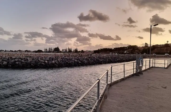
The 308-metre jetty is the waterfront’s main landmark. Built and opened in 1905, it replaced an earlier jetty that did not reach water deep enough for the larger steamships of the day. Today it is used for walking, fishing and seasonal blue swimmer crabbing, with several fish species also caught at night under the jetty lights.
Harbour Masters Park and the foreshore bring together native planting, seating, memorials, picnic areas, playgrounds, public toilets and beach access. Most visitors can explore this central area without moving the car.
The coastal trail continues south from the town centre. Local visitor information lists a 6.3-kilometre route from the jetty to Pitts Cutting, while the signed accessible foreshore section to the cemetery is about 1.2 kilometres one way. Conditions become more exposed and surfaces more varied beyond the central foreshore.
| Coastal feature | Physical character | Typical use | Important check |
|---|---|---|---|
| Oyster Bay | Sheltered eastern-coast bay facing Gulf St Vincent. | Swimming, boating, kayaking and views across the bay. | Wind can still change conditions, especially away from the inner foreshore. |
| Stansbury Jetty | Long linear structure extending 308 metres into the bay. | Walking, fishing, crabbing and viewing the shoreline. | Current fishing limits, weather and any maintenance restrictions. |
| Foreshore | Beach, lawns, shade, play areas and public facilities close to town. | Family visits, picnics, short walks and accessible recreation. | Check for temporary maintenance or event closures. |
| Boat ramp | Three-lane concrete ramp with boarding pontoons and a protective breakwater. | Launching recreational boats. | Marine forecast, ramp conditions and local boating rules. |
| Coastal trail | Paths begin on the town foreshore and continue to more exposed shoreline and cliff-top sections. | Short walks, fitness and connection to Walk the Yorke. | Distance, return plan, heat, wind and surface suitability. |
South of town, the sheltered foreshore gives way to a more varied shoreline of low bluffs, rock, rubble and sand. Farther south, reef platforms, cliffed sections and mixed rock-and-sand beaches become more common. In practice, a “coastal walk” may mean a level town path, a beach section, a cliff-top route or a longer shared trail.
Start beside the jetty, where paths pass native coastal planting, memorial plaques, seating, picnic areas, public toilets and open views across Oyster Bay. Families can combine the park, beach and nearby play areas without moving the car.
The centre occupies the historic 1877 post office at the corner of Weaver and Towler streets. It is a good first stop for maps, current local advice and ideas for day trips; opening times can vary, so check before making a special visit.
This regenerated cliff-top reserve gives broad views back over the township, jetty and Oyster Bay. It works well as a short scenic detour or picnic stop, although the site is more exposed to wind than the central foreshore and some surfaces may be uneven.
Public artworks around Stansbury depict blue swimmer crabs, pelicans, dolphins, oysters, the jetty, local markets and community history. They can be combined into a short self-guided loop through the foreshore and central streets.
Created for the 1973 centenary of the town’s naming, this community park is a quiet stop within the town area. It is best added to a central walking loop rather than treated as a separate half-day destination.
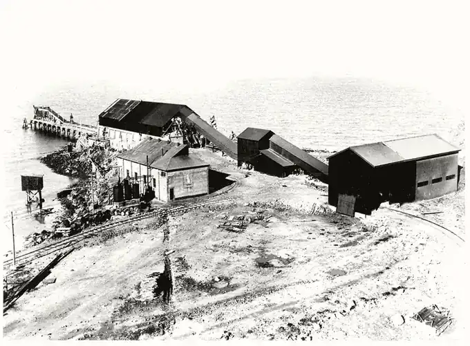
The working limestone quarry, coastal cliffs and loading jetty show that industry remains part of the district’s economy. View the area only from public roads and designated places: the industrial jetty and operational quarry areas are not open to visitors.
On selected dates from October to April, the foreshore hosts stalls selling local produce, craft and food. The markets are seasonal rather than weekly, so confirm the current event calendar before planning a trip around them.
Long-distance trail sections connect Stansbury with Port Vincent to the north and Edithburgh to the south. The official sections are substantial—about 17.6 and 29.2 kilometres—so plan water, sun protection, wind exposure and return transport, or choose a shorter out-and-back section.
Park near the jetty, walk out for views across Oyster Bay, then loop through Harbour Masters Park, the central foreshore and nearby streets. This plan needs little driving and still leaves time for photographs, a short beach stop and public facilities.
Add Stansbury Museum to the one-hour waterfront loop. Confirm the volunteer-run opening hours before arrival, allow about an hour inside, and use the remaining time for the jetty, foreshore and historic buildings near the town centre.
Choose one substantial addition rather than rushing between every stop: walk the accessible foreshore section, continue part-way towards Pitts Cutting, visit Mills Gully, or combine the murals with the visitor information centre. Carry water and adjust the plan for heat and wind.
Use Stansbury as a base and choose one direction: Port Vincent to the north, Edithburgh and Coobowie to the south, Yorketown inland, or a regional museum. A car is essential, and opening hours should determine the order of the day.
Its sheltered Oyster Bay setting, 308-metre jetty, fishing and crabbing, compact foreshore, local museum and position on the eastern Yorke Peninsula coast.
Yes. Port Vincent, Edithburgh, Coobowie and Yorketown are nearby, while the Copper Coast and Dhilba Guuranda–Innes National Park are each about 110 kilometres away.
Allow about an hour for a general visit, and longer if you plan to use the research room or read the displays in detail.
The central waterfront and town centre can be explored on foot. A car helps with Mills Gully, Pitts Cutting, Klein Point and nearby towns.
It is relatively sheltered compared with exposed southern coasts, but local wind and marine conditions still require attention.
No. The accessible foreshore section to the cemetery is about 1.2 kilometres one way. The longer route towards Pitts Cutting becomes more exposed and includes more varied surfaces.
Choose by subject: Ardrossan for agricultural invention, Kadina for farming and mining, Wallaroo for nautical and smelting history, or Bublacowie for military history.
Yes. Museum hours, prices, fishing rules, events and access conditions can change, so confirm time-sensitive details close to travel.
Start with the foreshore, then add the museum or a drive through the wider peninsula.
The coast helps explain how the town developed, while the museum shows how local people lived and worked.